
Uzaktan Algılama
Aperigae’s interpretation of remote sensing is further than applying digital techniques directly to detect and explore response of the Earth surface. Of course there are mature remote sensing and digital image analysis methodologies to directly apply on satellite imagery and get results which has been accomplished successfully at various conditions, regions, times with field proof.

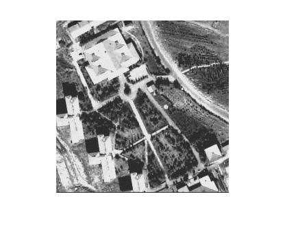
Aperigae’s interpretation of remote sensing is further than applying digital techniques directly to detect and explore response of the Earth surface. Of course there are mature remote sensing and digital image analysis methodologies to directly apply on satellite imagery and get results which has been accomplished successfully at various conditions, regions, times with field proof. However, to find real solutions for mining, agriculture, forestry, environment, disaster and so on, Aperigae uses other techniques, data sources, observations and best practices to support, combine or integrate with remote sensing. For instance, Aperigae supports remote sensing techniques with field observation by the domain experts, laboratory analysis, spectral observations on the field to increase the confidence and reduce the cost of other engineering solutions. The Aperigaes remote sensing approach also comprises analysis of multiple imagery with overlaping bands, using other sources for quality control and quality checking.
In addition to the capabilities in RS, The Aperigae RS aproach provides and interdisciplinary study by introducing GIS, spatial statistics, geospatial data mining and visual analytics to improve the findings and to localize the problem field. Aperigae cooperates with SMEs from Professional and research community to provide a whole coverage of application and theory for the problem field. In this respect Aperigae has a scientifically and professionally strong consultancy network comprising geology, geophysics, forestry, agriculture, soil, mining, environment fields. This gives Aperigae a comprehensive understanding of problem field which impacts on exploration activities and thematic data extraction to identify the best ways of overcoming the challenges.
Not like many other companies or research grups, Aperigae make use of limits of remote sensing data and interdisciplinary methodology along with skillful image processing to decrease investment costs of further works and increase impact of decisions to be made. At the end of the analysis, the findings are evaluated by our SMEs having expertiese and experience to explore and identify the expected spatial processes, detect structures and patterns, and assess the likelihood of findings with required confidence levels.
Aperigae provides the following RS services;
- Image enhancement and visualization,
- Satellite imagery interpretation for the mapping of the phenomena,
- Image analysis by using multiple approaches and methods,
- Introducing GIS, spatial statistics, spatial data mining for interdisciplinary problem solving,
- Interpretation of 2D and 3D sensor data and integration with ancillary data to produce 3D models and visualization,
- Thematic mapping and visualization on GIS products for better communication and interpretation
© Copyright 2025 Aperigae.com