
UAV Photogrammetry and UAV LiDAR
Aperigae provides UAV solutions by cooperation with partners for the specific survey task. Aperigae’s main expertiese is on UAV data processing and analysis

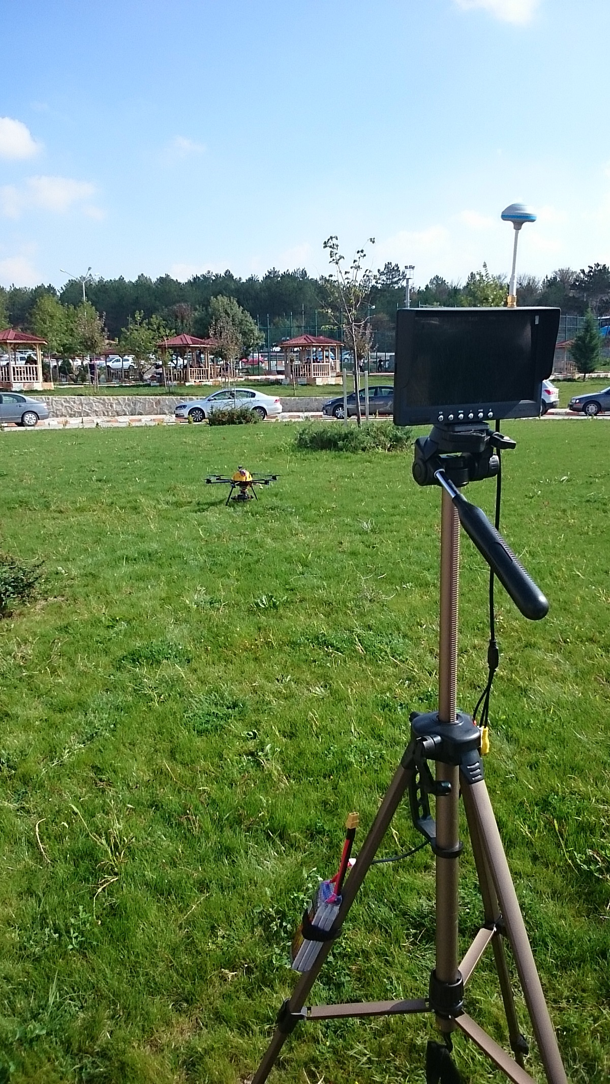
Aperigae provides UAV solutions by cooperation with partners for the specific survey task. Aperigae’s main expertiese is on UAV data processing and analysis. The data capturing phase is handled with other cooperating partrners.
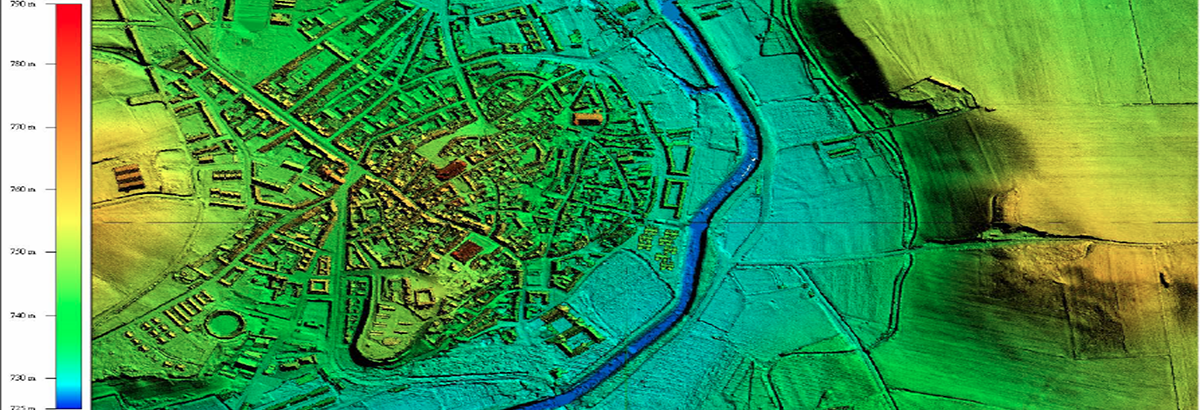
By introducing Aperigae’s expertiese on aerial photogrametry, aerial triangulation, computer vision, photogrammetric computer vision, UAV surveying, UAV data analysis and data generated by UAV are provided to the customers with all pro’s and con’s of the products (image mosaics, 3D clouds and DSM) for their particular Project. Aperigae, provides an image mosiac and 3D point cloud. The Aperiga UAV workflow is as follows;
- choosing the most appropriate UAV type (drone or multi-copter)
- UAV flight planning, execution of flight, capturing the images (cooperated with partner company)
- İmage analysis, 3D point generation, image mosaic generation and QC procedures
- Converting the products into required formats and standrds for GIS use.
Aperigae’s UAV service gives the customer a completely different pespective about the phenomena that UAV observes. UAV is used for multiple fields and purposes such as; property or landscape inspection, contour generation, volumevolümelations, visual crop inspection, damage analysis, real estate advertisement, promotional purposes, archaeological surveys, environmental monitoring and many more.
Aperigae plans to invest for a UAV LiDAR sensor for engineering surveying, monitoring surface deformation, reservouir mapping, river shore mapping among others.
© Copyright 2025 Aperigae.com